IMAGES FROM CHAPTER 4
please check gray text for attribution and licensing restrictions
images in copyright are not available for download
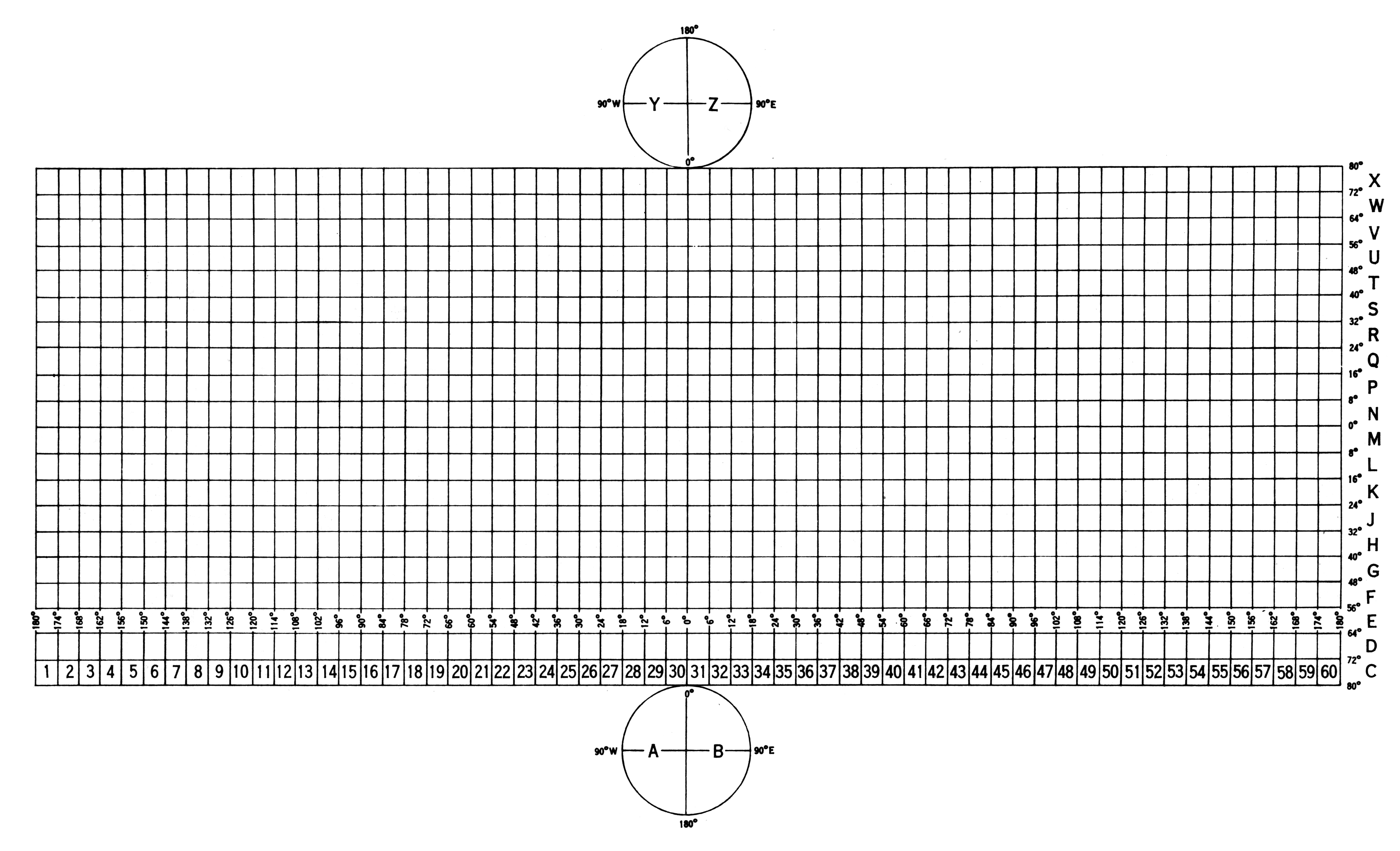
| FIGURE 4.1 |
| The Universal Transverse Mercator grid system, shown as if all maps were laid together like an unfolded globe download grid as a GIS layer | |
| William Rankin Creative Commons BY-NC-SA | |

| FIGURE 4.2 |
| Use of the Universal Transverse Mercator grid (and its Soviet counterpart) by the end of the Cold War | |
| William Rankin Creative Commons BY-NC-SA | |
| FIGURES 4.3 AND 4.4 |
| British and American grids during World War II | |
| from US Army Map Service Memorandum No. 425, Grids and Magnetic Declinations, 2nd ed. (Washington DC, 1943); shading added Public Domain: US government | |
| FIGURE 4.5 |
| The first two reference levels of the US Air Defense Grid | |
| from War Department Technical Manual TM 44-225, Orientation for Artillery (Washington DC, 1944); shading added Public Domain: US government | |

| FIGURE 4.6 |
| The most precise references on the US Air Defense Grid | |
| from War Department Technical Manual TM 44-225, Orientation for Artillery (Washington DC, 1944); shading added Public Domain: US government | |

| FIGURE 4.7 |
| The US Joint Army–Navy reference system, applied to individual map sheets | |
| from War Department Technical Manual TM 44-225, Orientation for Artillery (Washington DC, 1944); shading added Public Domain: US government | |
| FIGURE 4.8 |
| Expansion of the US Joint Army–Navy system to adjacent sheets (original map is square M) | |
| from War Department Technical Manual TM 44-225, Orientation for Artillery (Washington DC, 1944); shading added Public Domain: US government | |
| FIGURE 4.9 |
| Top-level “Grid Zone Designations” for the Universal Transverse Mercator grid | |
| from US Army Map Service Technical Manual No. 36, Grids and Grid References (Washington DC, 1950) Public Domain: US government | |

| FIGURE 4.10 |
| Grid Zones subdivided into 100-kilometer squares | |
| from US Army Map Service Technical Manual No. 36, Grids and Grid References (Washington DC, 1950) Public Domain: US government | |
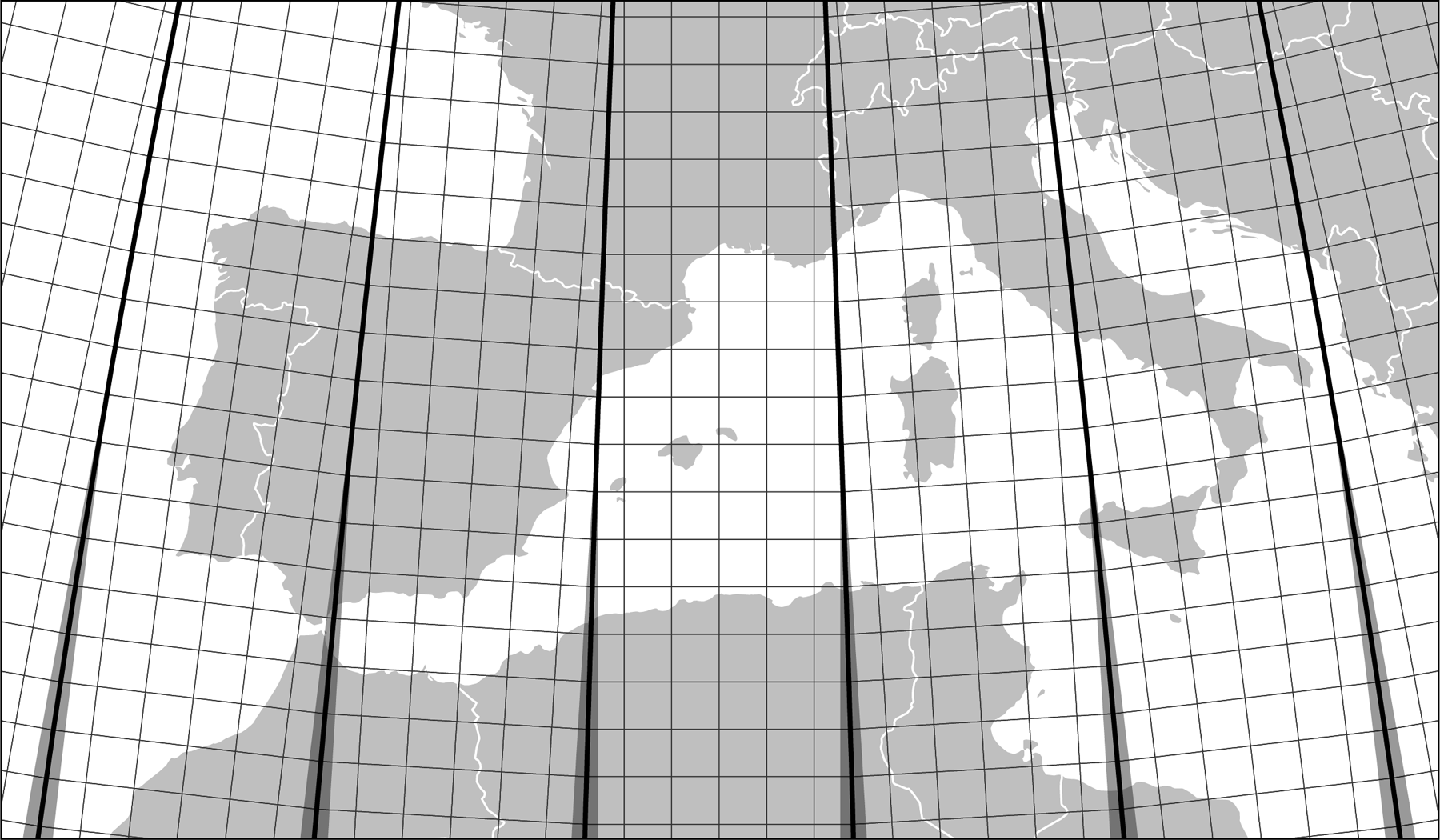 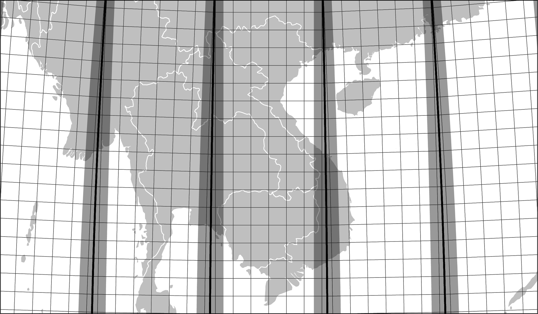
| FIGURE 4.11 |
| Areas of the Universal Transverse Mercator grid with high errors (in dark gray) for Europe and Southeast Asia download grid as a GIS layer | |
| William Rankin Creative Commons BY-NC-SA | |

| FIGURE 4.12 |
| Ellipsoids used for the Universal Transverse Mercator grid | |
| from US Army Map Service Technical Manual No. 7, Universal Transverse Mercator Grid Tables (Washington DC, 1949?) Public Domain: US government | |
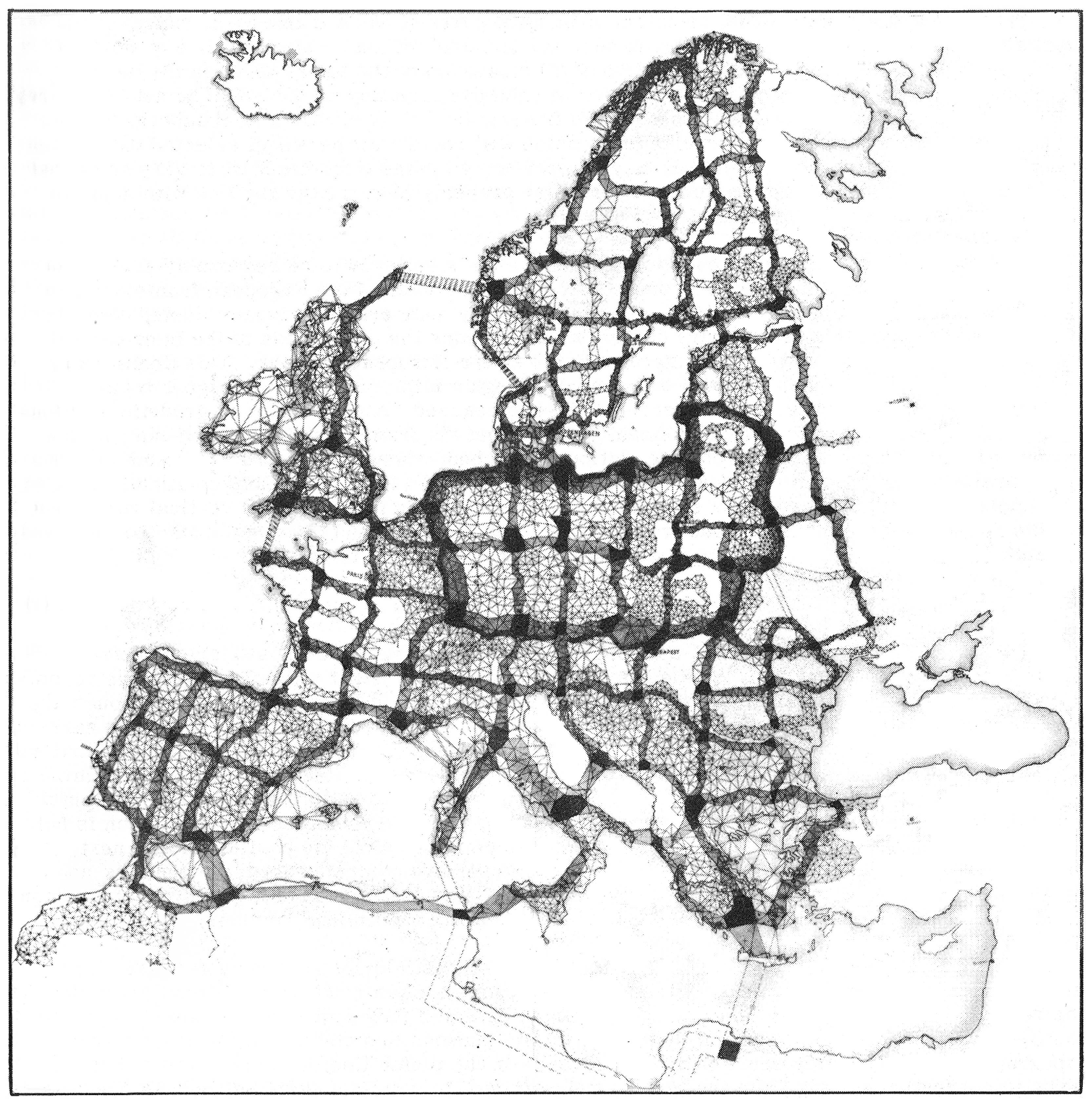
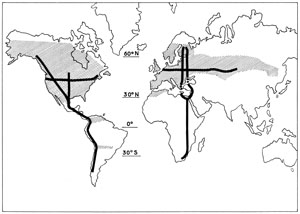
| FIGURE 4.13 |
| The US Army Map Service's scheme for recalculating the European triangulation, 1947 | |
| from Floyd Hough, “The Readjustment of European Triangulation,”
Transactions, American Geophysical Union 28 (Feb 1947), 63 Public Domain: copyright not renewed | |
| FIGURE 4.14 |
| High-precision survey data used by the US Army Map Service to recalculate the size and shape of the earth in 1956 | |
| Bulletin géodésique Copyright 1959 | |
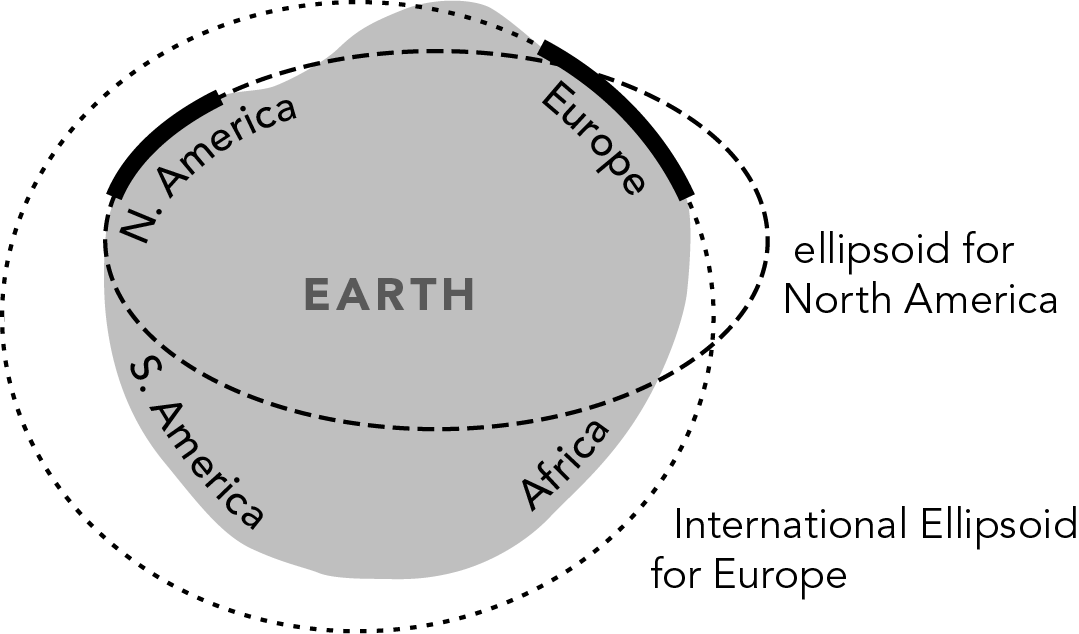
| FIGURE 4.15 |
| Mismatches between North-American and European values for the size and shape of the earth | |
| William Rankin, after Irene Fischer Creative Commons BY-NC-SA | |
| continue to chapter 5 . . . | |