All GIS layers are in Shapefile format (GIS software required).
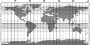
| GIS LAYER FROM FIGURE 1.4 |
| Sheet layout of the International Map of the World – 4° × 6° grid, with sheet numbers | |
| William Rankin Creative Commons BY-NC-SA | |
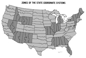
| GIS LAYER SIMILAR TO FIGURE 3.13 |
| Zones of the US State Plane Coordinate System | |
| data from ESRI | |
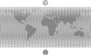 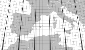
| GIS LAYERS FROM FIGURES 4.1 AND 4.11 |
| Grid lines of the Universal Transverse Mercator system – grid zones and 100-km grid, with Military Grid Reference System info | |
| data from the US National Geospatial-Intelligence Agency | |
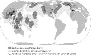
| GIS LAYERS FROM FIGURE 5.11 |
| Loran during World War II – transmitter locations and chain connections (see image for coverage extent) | |
| data from J. A. Pierce, A. A. McKenzie, and R. H. Woodward, eds., Loran: Long Range Navigation (New York: McGraw Hill, 1948), appendix B | |
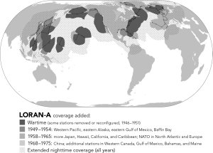
| GIS LAYERS FROM FIGURE 5.24 |
| Loran-A after World War II – transmitter locations and chain connections (see image for coverage extent) | |
| data from loran-history.info and “Loran-A is Alive and Well... and Living in China,” Wild Goose Association Radionavigation Journal (1985–1986): 47 | |
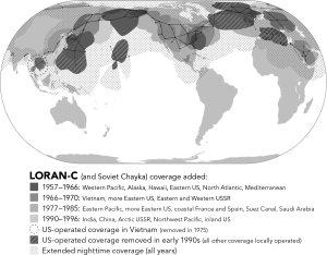
| GIS LAYERS FROM FIGURE 5.25 |
| Loran-C – transmitter locations and chain connections (see image for coverage extent) | |
| data from loran-history.info, Wikipedia (including Soviet Chayka), and “Suez Canal Loran-C Installed,” Wild Goose Association Newsletter (Summer 1982): 5−6 | |
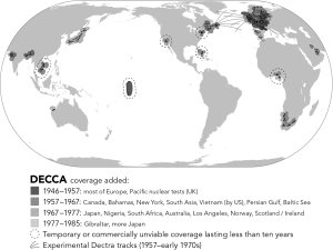
| GIS LAYERS FROM FIGURE 5.23 |
| Decca Navigator – transmitter locations and chain connections (see image for coverage extent and Dectra tracks) | |
| data from Jerry Proc; for approximate locations of nuclear-test stations in the Pacific, see “Operation Grapple,” Decca Navigator News 21 (Dec 1957): 6–7 | |
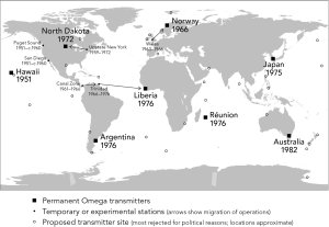
| GIS LAYER FROM FIGURE 6.7 |
| Omega transmitter locations – final stations only | |
| data from Peter B. Morris et al., Omega Navigation System Course Book, Vol. 1 (Alexandria: US Department of Transportation, 1994), pages 2-11 to 2-21 | |
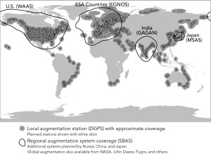
| GIS LAYERS FROM FIGURE 6.18 |
| Differential GPS beacons (approximate coverage shown with 200-nm buffers) | |
| data from Alan Gale's DGPS Beacons of the World (use Ctrl-F to find it on this page) | |
